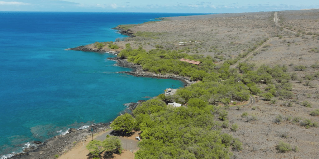
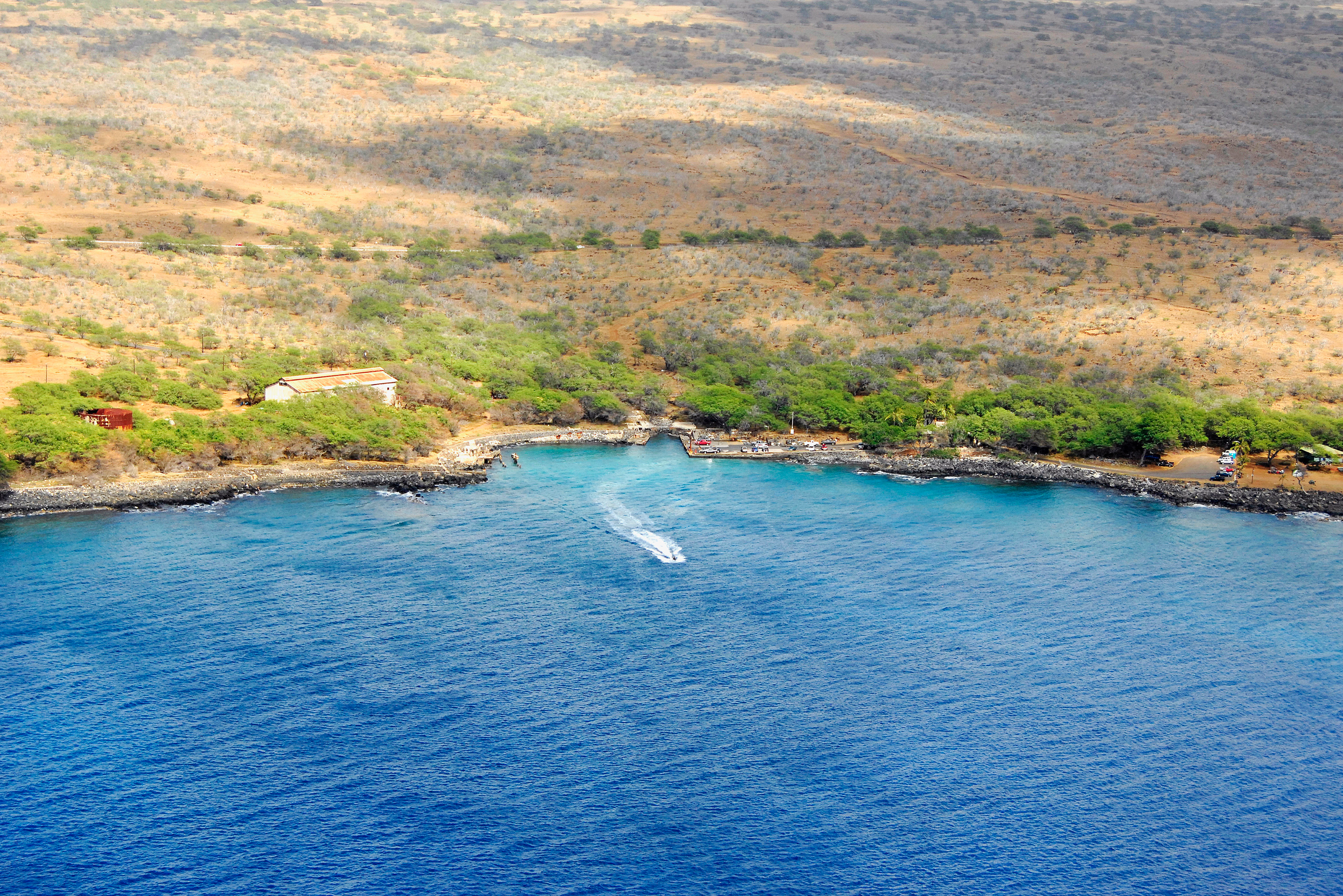
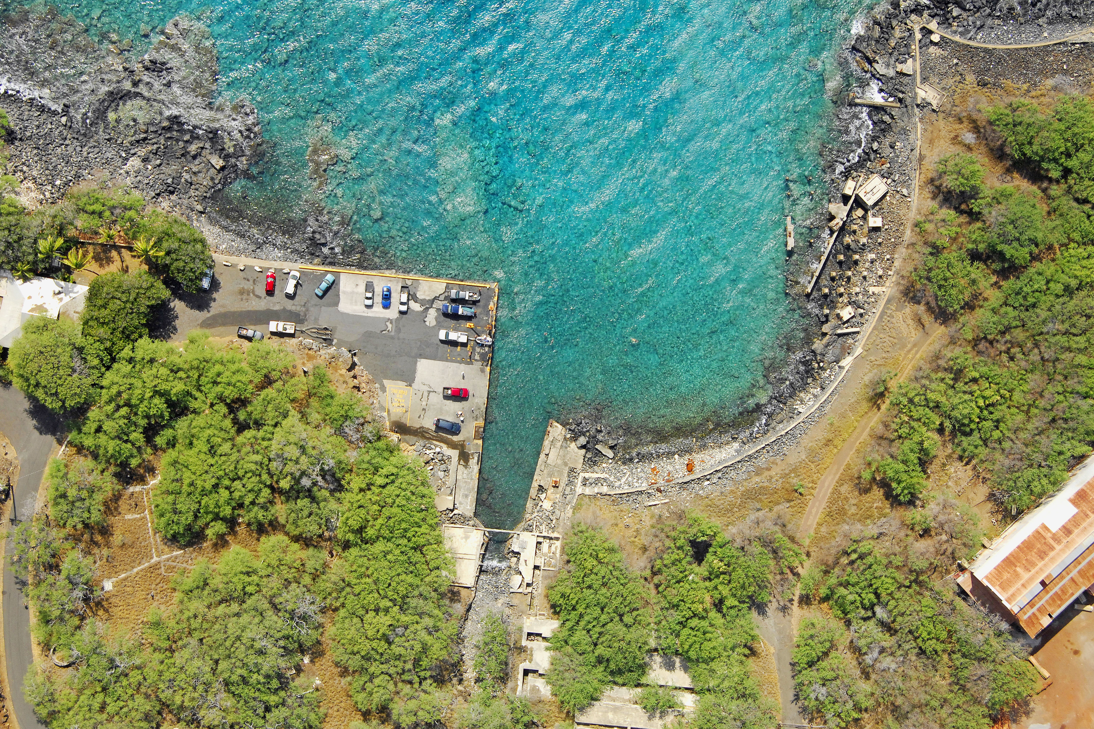
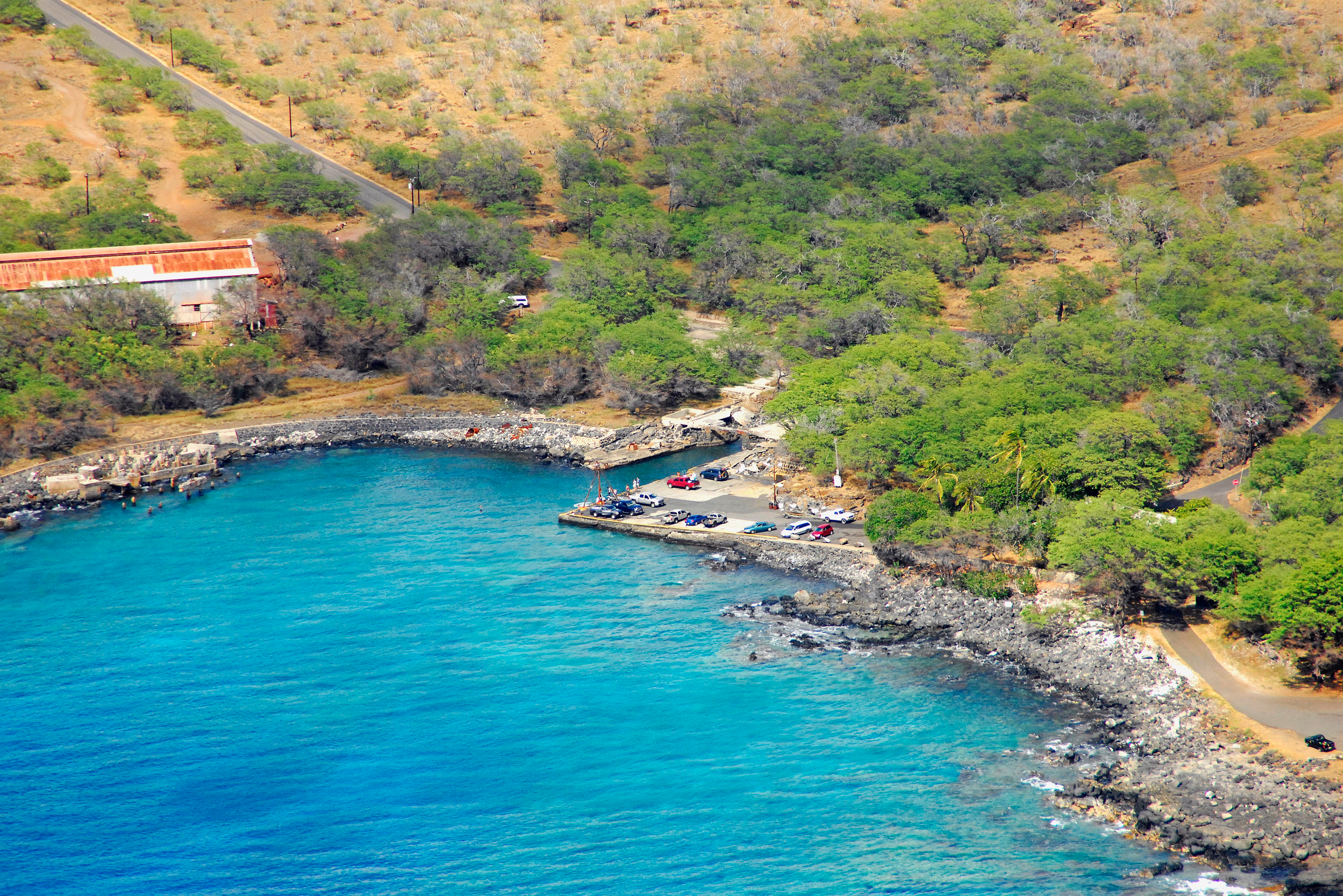
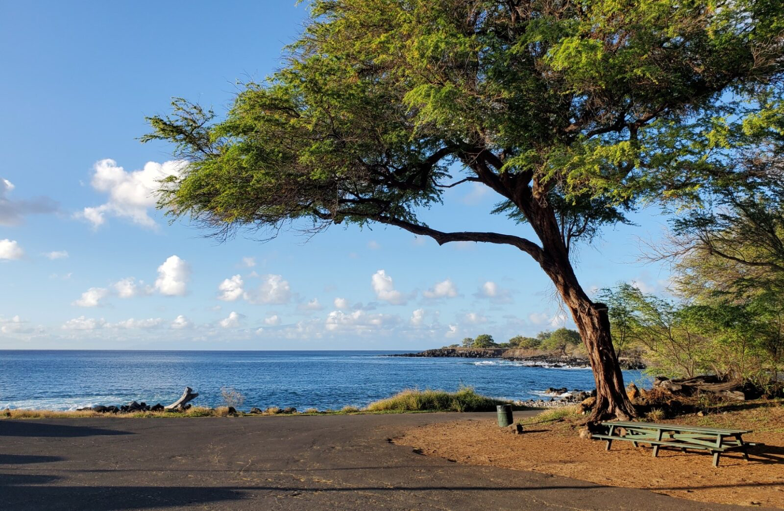
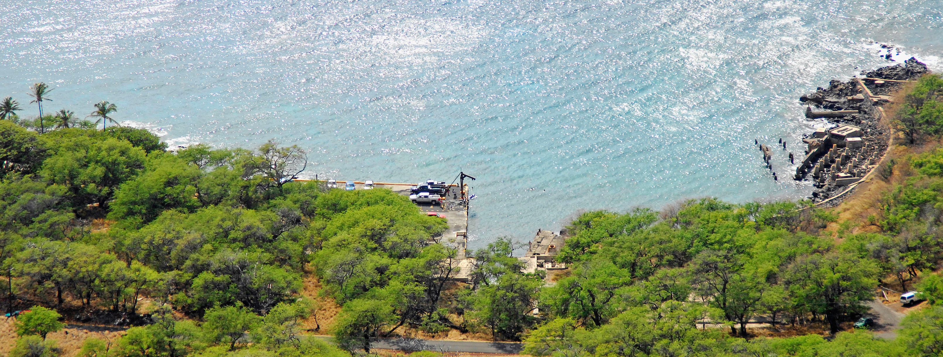
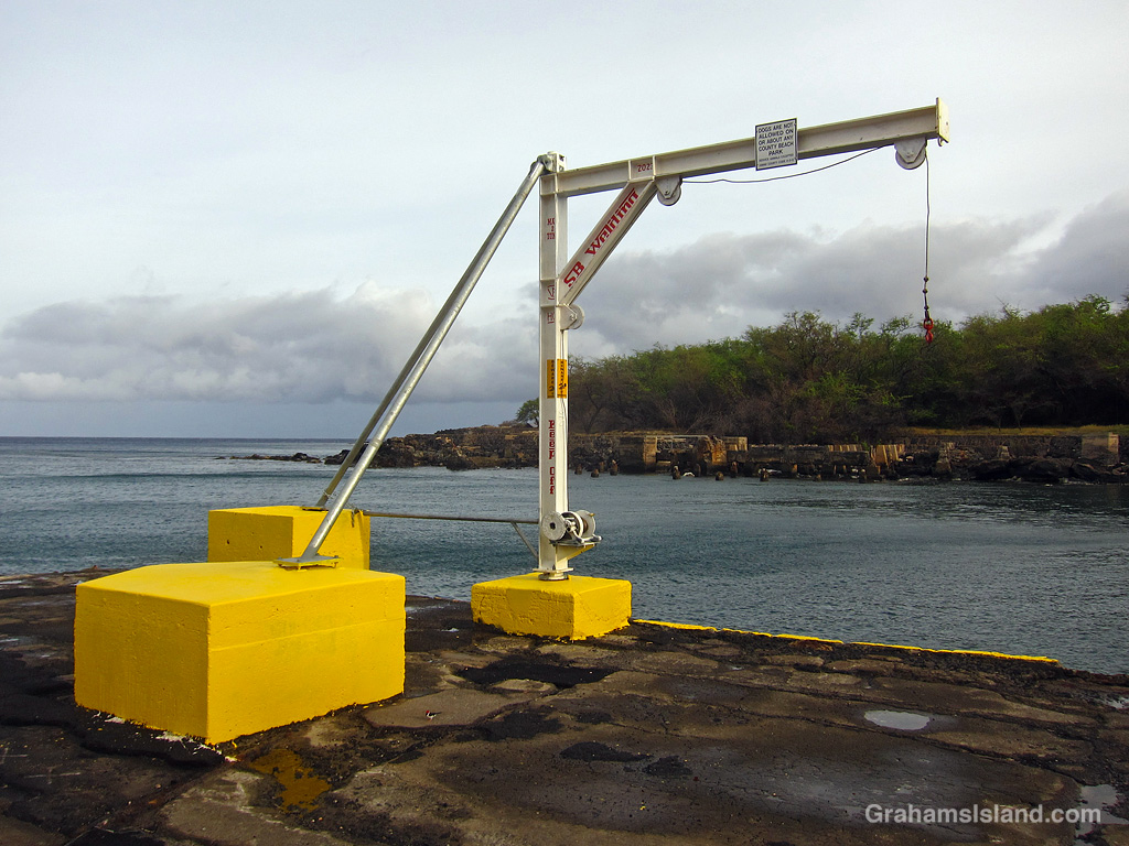
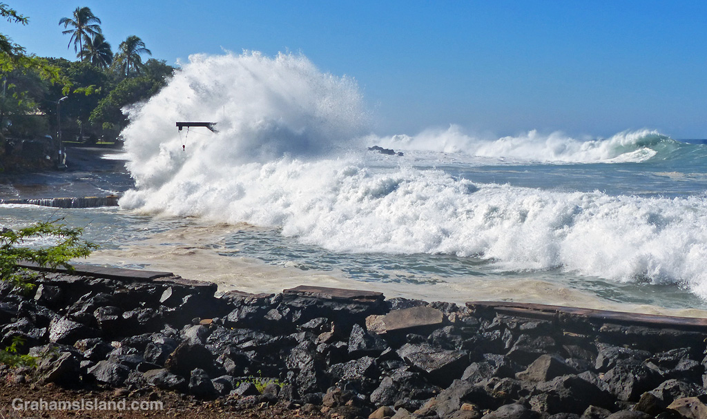
Māhukona has a concrete pier, a boat launch and, on most days, water calm enough to launch a small fishing boat without too much trouble. This section of coast on the leeward side of Kohala is mostly rock and broken lava dropping straight into deep water. For the people of North Kohala, roughly twenty miles from Kawaihae Harbor to the south, this is the only option.
This is why the struggle over who can use Māhukona, and on what terms, has never really been about recreation. It is about fishing. For generations, families on this coast have fished these waters for subsistence, for income, and for the kind of relationship with the ocean that does not have a clean English translation.
When your only practical boat launch for twenty miles is threatened, the stakes are immediate and concrete. It means a twenty-mile drive to Kawaihae just to get on the water. It means time and fuel and the slow erosion of that invaluable feeling of malama and kuleana that was once simply part of how you lived here.
Before everything changed, before ‘Ai Noa and Great Mahele, before ahapuaʻa became private property, Māhukona was a small fishing village. But the harbor at Māhukona was not built for fishing. It was built for sugar.
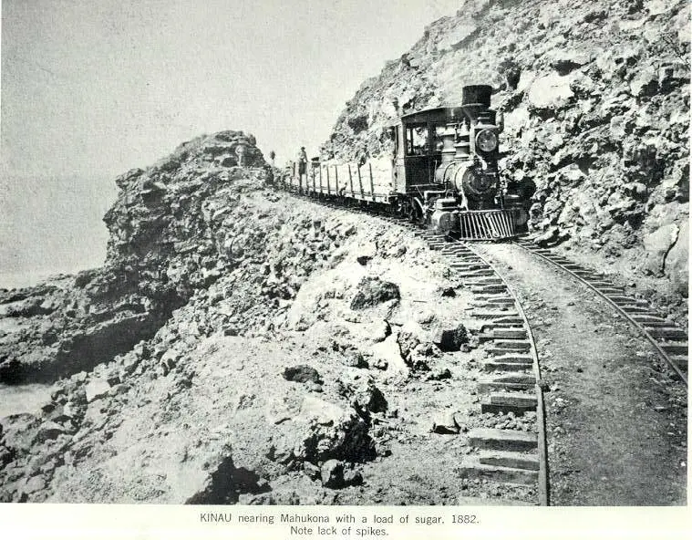
In the 1880s, the Kohala Sugar Company needed a way to ship its product off this coast, and the small protected cove at Māhukona—sheltered enough by its natural curve and later by the breakwater and pier that were added over the years—was the best option available.
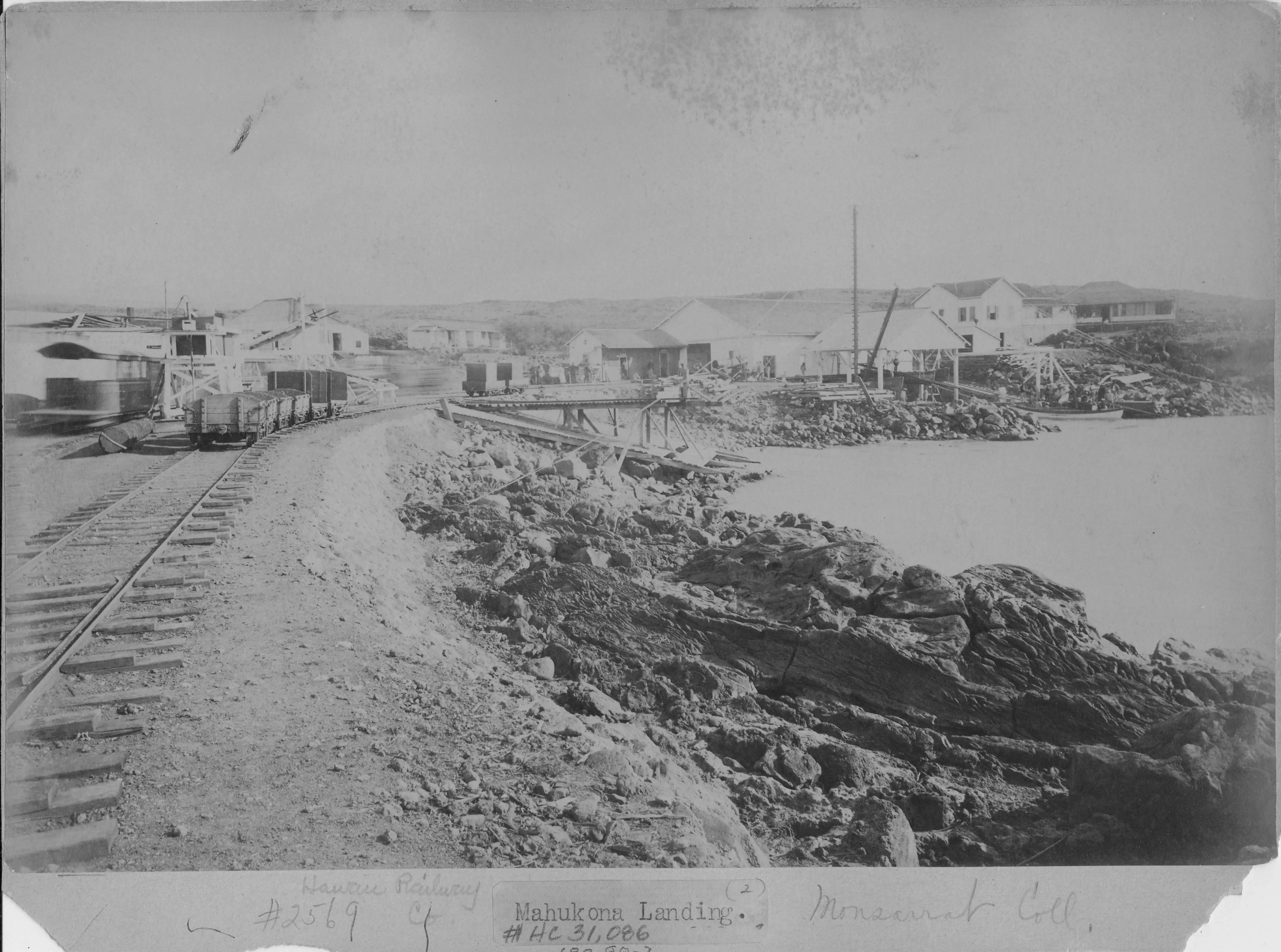
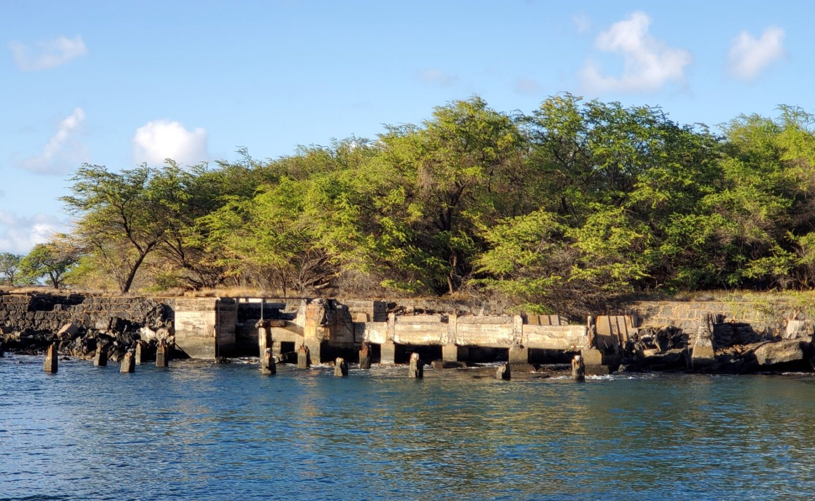
The railroad that Samuel Wilder built in 1880 ran twenty miles from the windward mills to this harbor, and for sixty years North Kohala’s sugar left the island from this pier. By 1913 it was the fourth busiest port in Hawaiʻi.
Then the sugar economy collapsed. The railroad closed in 1945. The harbor shut down for good in 1956. The town of forty families dispersed. What the plantation had built was left behind: the concrete pier, the aging breakwater, the infrastructure that incidentally created the only sheltered small-boat water for a long stretch of this coast. The community that remained—the families who had not left, whose parents and grandparents had worked the mill and fished these same waters—simply continued using it. They fished from the pier, launched their boats, swam, camped, gathered. For thirty years after the harbor closed, this was what people did at Māhukona.
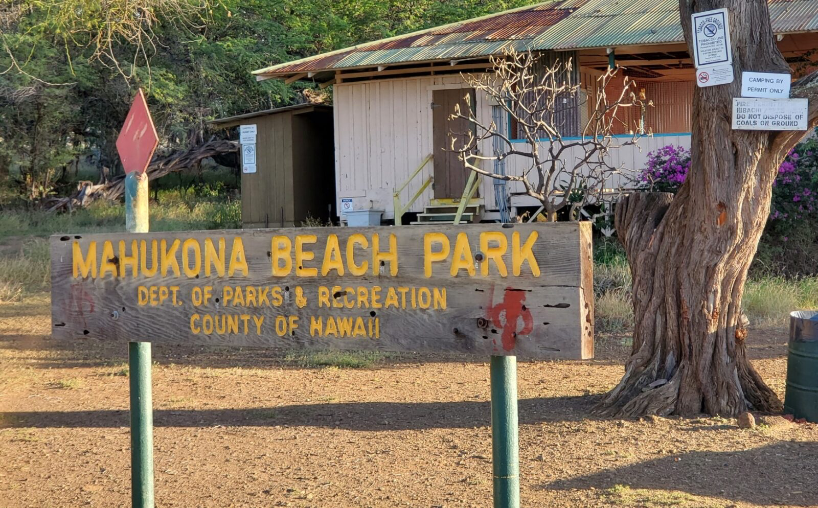
That changed in 1989 when a foreign developer named Chalon International bought the land surrounding the harbor and put up gates. Almost overnight, roads and trails that the community had used freely for decades were blocked. The public park right at the water—Māhukona Beach Park—remained technically open, but the access routes to it and to the surrounding coastal land were cut off. Nishimura Bay, a cove just adjacent to the harbor that had been one of the most popular recreation spots in North Kohala, was suddenly off-limits.
The community pushed back through the courts. Hui Māmalahoa, a local nonprofit, fought three separate lawsuits in the 1980s and won legal public access rights each time.
But the developer put up fences and rock barriers anyway. The County passed Ordinance 93-109 and issued a permit requiring shoreline access. The developer ignored it, issuing his own self-made permits and controlling who could come and go. For years the situation stayed that way: legal rights on paper, obstructed access in reality.
This was not simply a fight about a park. It was a fight over whether a foreign investor could effectively privatize a stretch of coastline that a community had used for generations, by buying the land surrounding the only safe boat launch for twenty miles. The 1988 State of Hawaiʻi Harbors Division had formally studied the question of boat launch facilities in North Kohala and documented what the community already knew: Māhukona was the district’s critical access point for small watercraft on this coast.¹ When that access was blocked, the people most affected were not tourists or recreational boaters. They were North Kohala families for whom getting a boat in the water at Māhukona was how they fished.
The County’s official shoreline inventory still lists Māhukona Harbor today as providing “diving, fishing, swimming” access, with the note “hazardous boat traffic”—meaning boats are actively going in and out, the County knows it, and the facility is formally recognized as a launch point.² But recognition on paper and functional public access are two different things, as the community learned through three decades of fighting.
The fight finally ended in 2023 when Hawaiʻi Land Trust purchased the full 642 acres surrounding the harbor for thirteen million dollars, with funding from the County, the State, the federal government, and private donors.³ The land is now permanently protected under a conservation easement. It cannot be developed. Public access is required. The co-stewardship agreement between Hawaiʻi Land Trust and Nā Kālai Waʻa, the voyaging organization based at Māhukona, ensures that the cultural and educational uses of the site will be actively maintained going forward.
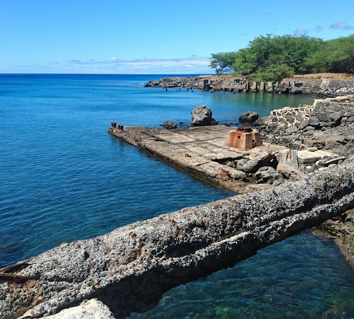
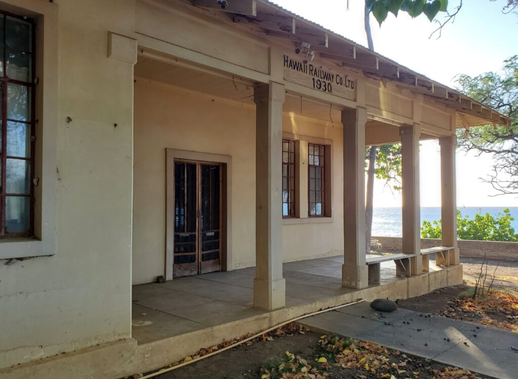
What is not yet resolved is the condition of the infrastructure itself. The pavilion at Māhukona Beach Park was closed for years because of hazardous materials from its original 1930s construction and general decay, and it was demolished in January 2025.
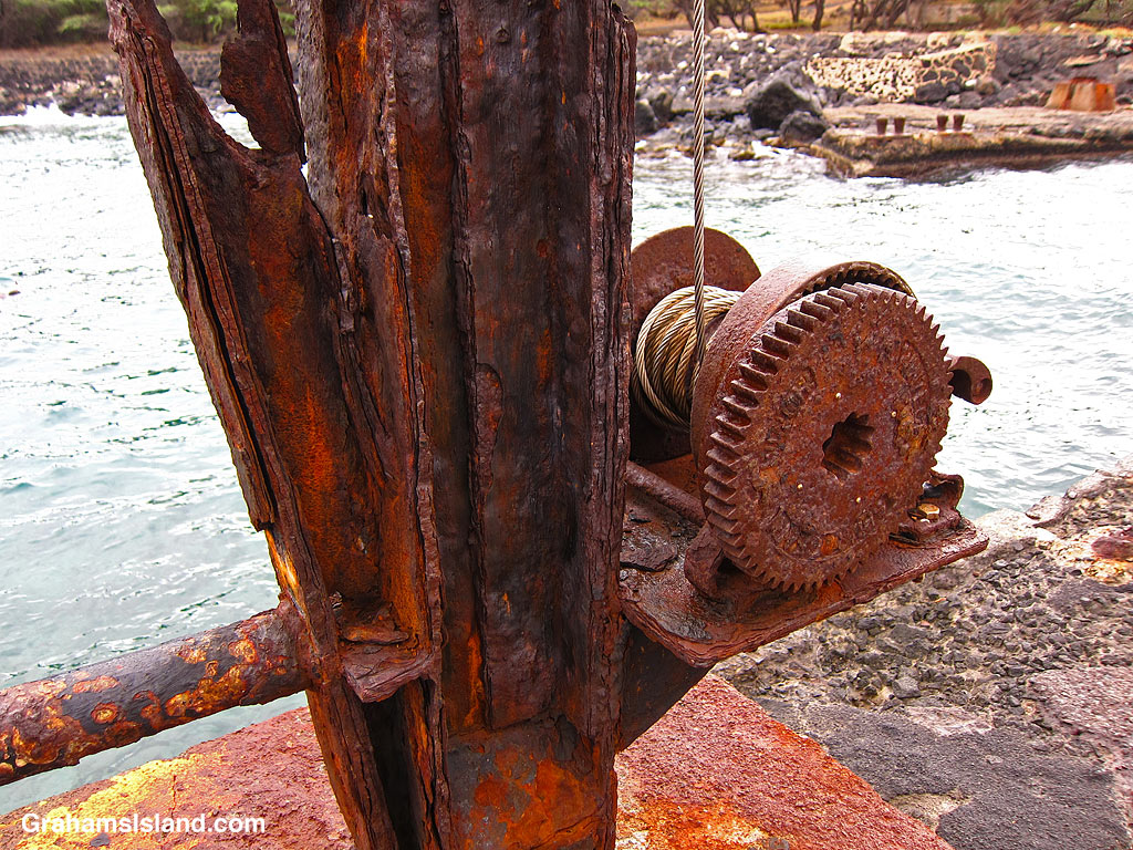
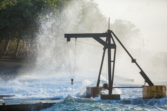
The pier and ramp—the old sugar-era structures that have served as the practical small boat facility since 1956—are aging and have received no significant investment.
Mayor Kimo Alameda, announcing the pavilion closure, said the County looks forward to “collaborating with community members on the future of Māhukona Beach Park.”⁴ That collaboration has not yet produced a plan.
So the harbor is protected. The access is legally secured. The developer is gone.
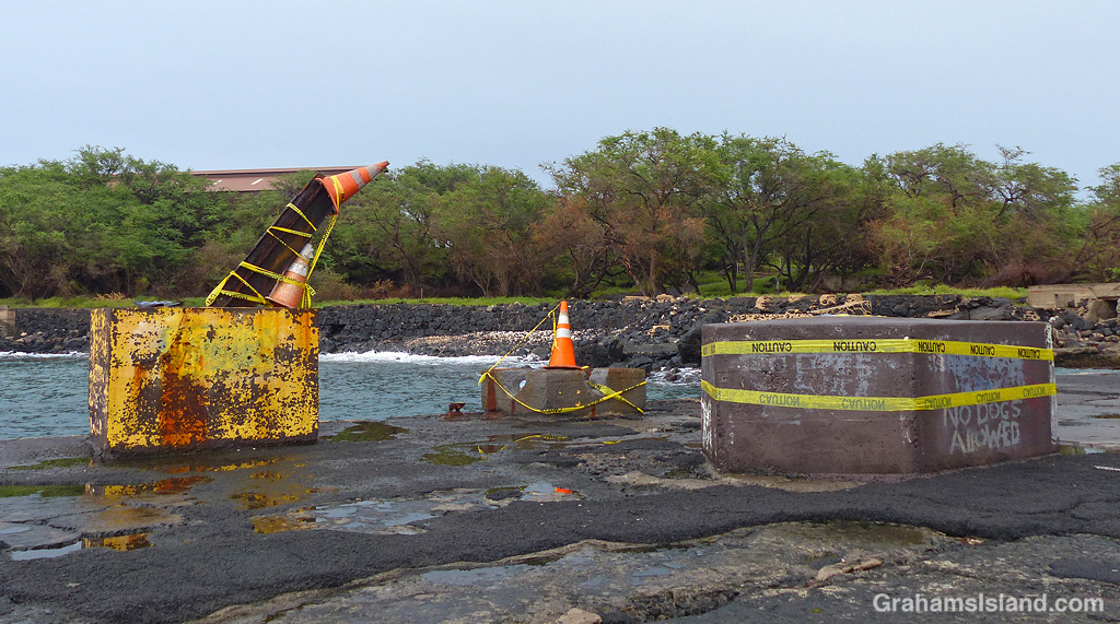
But the physical facilities that make Māhukona functional as a small boat harbor—the pier, the ramp, the concrete infrastructure that the sugar economy built and that the community has used for sixty years—remain in the condition they were in before any of this happened.
The legal victory preserved what was there. What comes next? Will the community demand genuine improvements and protection for what they fought so hard and long to keep? Will politicians listen? Or will discontent continue to simmer with no resolution?
What do you think should happen here?
¹ Michael S. Chu, Boat Launch Facilities for the District of North Kohala, Island of Hawaii (Honolulu: Harbors Division, Department of Transportation, State of Hawaii, 1988), cited in the bibliography of the 2007 East Carolina University maritime archaeology thesis on the Māhukona wreck site.
² Hawaiʻi County Planning Department, “North Kohala Shoreline Public Access,” https://www.planning.hawaiicounty.gov/resources/shoreline-public-access/north-kohala.
³ Big Island Now, “Hawaiʻi Land Trust Purchases 642 Acres at Mahukona,” December 13, 2023; Hawaiʻi Land Trust, “Māhukona Cultural and Ecological Refuge,” https://www.hilt.org/mahukona.
⁴ Mayor Kimo Alameda, quoted in Howzit Kohala, “Māhukona Beach Park to Close for Demolition of Pavilion,” December 20, 2024.

Leave a comment